

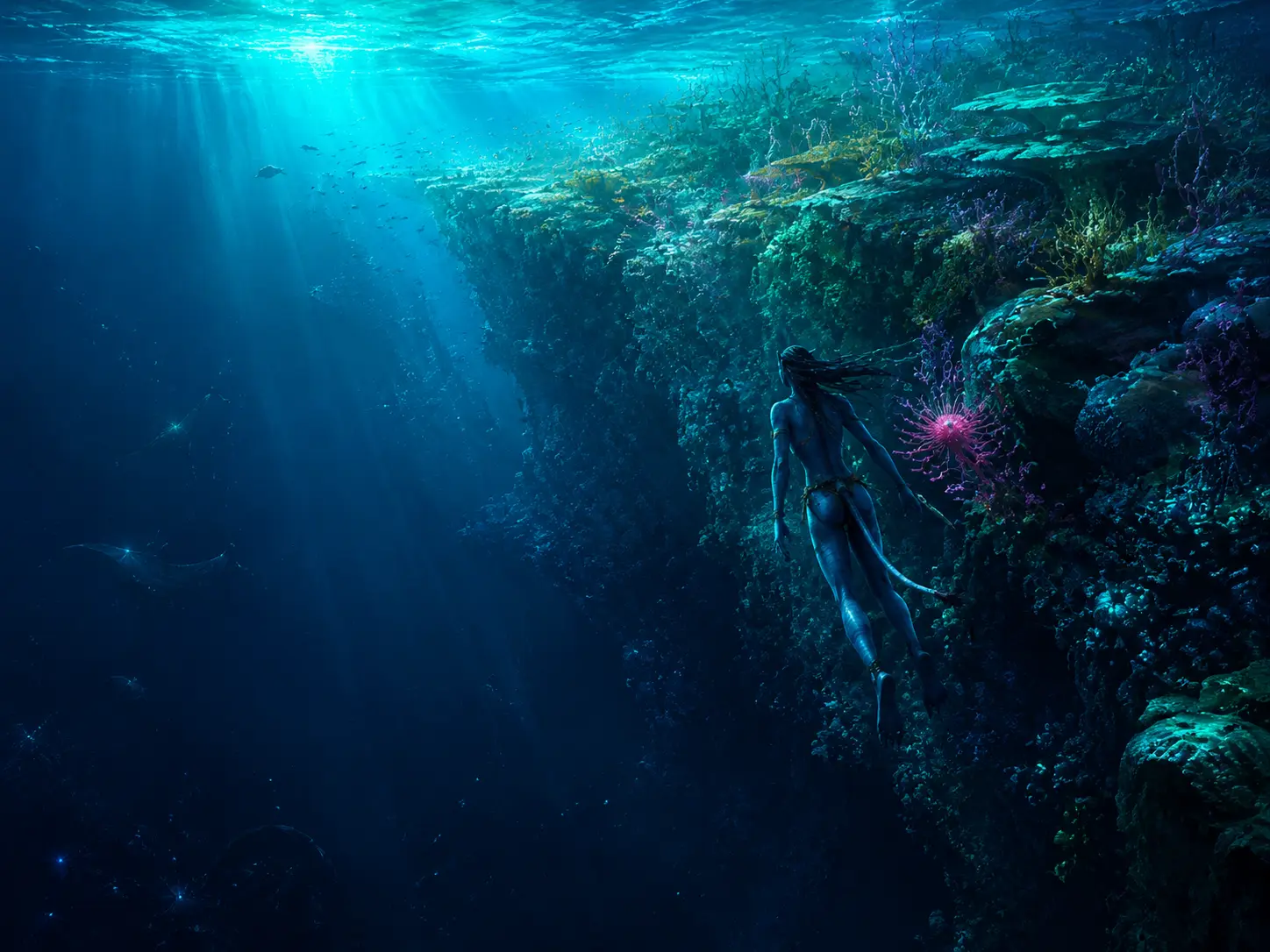
Leave the shallows at Awa'atlu and let the water take your first metre.
Above you, the reef is all colour and edges. Sunlight makes a moving lattice on the sand. Fronds bend, small bodies flash and vanish, and every surface seems occupied. Then the bottom tilts away. Cyan becomes blue; blue thickens toward indigo. You have crossed no gate, touched no wall and heard no warning, yet the world has changed around your skin.
Warm surface water can float above colder water for the same reason oil floats above water: it is less dense. Add differences in dissolved salt and the arrangement becomes more stubborn. The ocean acquires floors that cannot be stood upon.
Cinema is very good at the first of these floors. The Way of Water gives the Eastern Sea a glittering surface, protected lagoons, passages through reef-like structures, open water large enough for migrating animals and depths dark enough to require living light or machinery. It gives us swimmers who know the water intimately and invaders who cross it with propellers, sonar and violence.
It does not give us one seawater profile.
No canonical instrument readout settles the Eastern Sea's salinity, temperature, pH, dissolved oxygen, nutrient content or maximum depth. No global bathymetric chart tells us whether Awa'atlu stands over an oceanic plateau, a continental margin or some structure with no close Earth analogue. Numbers repeated by fan compilations do not become official because they are precise. The useful specimen is therefore partly negative: a sea shown with extraordinary care and measured almost not at all.
That silence leaves room for a better question than "How deep is Pandora's ocean?"
What would make an ocean like this work?
The sea is not one thing
Take a clear container of water, warm its top and leave it alone. The warmer water expands slightly, becomes less dense and stays above the colder water. Stir it and the distinction blurs. Stop stirring and heating rebuilds it. Dissolve extra salt in one layer and density changes again. Temperature and salinity are different levers pulling on the same outcome: which water parcel can float above which.
An ocean turns this simple demonstration into geography. Sunlight heats its skin. Rain and rivers freshen some regions. Evaporation leaves salt behind in others. Winds stir the surface; storms punch deeper; cold nights let surface water lose buoyancy and sink. Ice, where a world permits it, rejects salt as it forms and releases fresh water as it melts. Tides drag layers across ridges and shelves. Each process either builds a density difference or spends energy breaking one.
The result is ocean stratification: water organised into layers because moving a dense parcel above a light one costs energy. The top is usually a mixed layer, churned enough by wind and waves to be comparatively uniform. Beneath it may sit a pycnocline, a depth interval where density rises quickly. Temperature may supply most of that change, producing a thermocline; salinity may contribute through a halocline. Below lies a much larger body of deep water that changes slowly because sunlight never reaches it directly.
The words matter less than the feeling. A pycnocline is a hill made of buoyancy. Water can cross it, but something must pay the energetic fare.
A vertical ocean
Move through the water column; switch the circulation regime.
Move the probe down the column. Light collapses first. Warmth falls through the transition. Nutrients move in the opposite direction, increasing beneath the layer where microscopic producers have already spent them. The profiles are deliberately relative rather than Pandoran measurements; canon supplies none. Their shapes are the lesson.
Switch to upwelling and the boundary rises. Deep characteristics approach the surface without making the whole ocean uniform. That distinction prevents a common mental error. Mixing is not the disappearance of structure. It is transport across structure, sometimes local and temporary, sometimes powerful enough to rebuild a region's ecology.
The Eastern Sea's clear shallows fit comfortably inside this physics, but they do not prove a particular profile. Clear tropical water on Earth often sits beneath strong heating and over a permanent pycnocline. Pandora might do the same. A dense atmosphere could change the wind's grip; unfamiliar salts could change the density equation; different rotation and gravity would alter currents and waves. Until somebody lowers an instrument, those remain variables, not lore.
What survives the uncertainty is more modest. Liquid water under uneven heating and stirring will organise. If the Eastern Sea has warm sunlit water above colder deep water, moving material between them will be work.
That work pays for life.
Light above, food below
The bright surface seems like the obvious place to be alive. Photons arrive there. Photosynthetic organisms can capture their energy and use it to assemble carbon dioxide, water and nutrients into new tissue. The useful light penetrates only a fraction of the ocean, however. Oceanographers call the layer in which photosynthesis can exceed respiration the euphotic zone. In clear water it may extend surprisingly deep; in muddy coastal water or a dense plankton bloom it may end much sooner.
Light is only one ingredient. A cell also needs nitrogen, phosphorus, iron and other elements. Near the surface, successful growth consumes those dissolved materials. Grazers eat the cells. Cells die. Waste particles stick together. A slow snowfall begins.
Some flakes are individual cells. Others are faecal pellets, mucus, fragments of bodies or aggregates crowded with bacteria. Oceanographers gave this material the unromantic and perfect name marine snow. It drifts out of the lit layer carrying carbon and nutrients with it.
On the way down, consumers dismantle it. Bacteria respire its carbon, using oxygen and returning nitrogen and phosphorus to dissolved forms. Zooplankton intercept it. Fragile aggregates break and re-form. Most of the material never reaches the seafloor; its atoms are regenerated somewhere in the water column. The fraction that continues downward can remain in deep water for decades or centuries, or enter sediment for much longer.
This collection of biological exports is the biological pump. It does not resemble a machine with a piston. It resembles weather: innumerable small events whose sum moves carbon from the atmosphere-facing surface into the ocean interior.
Now the ocean's central inconvenience appears. The energy is above. The recycled nutrients are below. A stable density boundary keeps them apart.
In many open subtropical waters on Earth, that separation produces a blue so clean it is almost empty. Few particles scatter green light because few large phytoplankton can grow. The water is not barren, but its food web is built around tiny cells and tight recycling. Clear water advertises the absence of suspended abundance as much as it advertises purity.
This complicates a first reading of Awa'atlu. Its turquoise clarity and crowded life are visually compatible, but not self-explanatory. A reef can recycle nutrients efficiently. Animals can move food across habitats. Currents can focus plankton. The island itself can disturb flow. None of those mechanisms is named in the film. All are better questions than assuming that bright tropical water is automatically fertile.
The same vertical traffic changes climate. Carbon fixed near the surface can return quickly as carbon dioxide or travel into water isolated from the atmosphere. How long it stays depends on depth, circulation and chemistry. The pump therefore links a drifting cell too small to see with the carbon inventory of the planet.
Pandora's ocean almost certainly has some route for sinking matter, because large marine bodies eat, excrete and die. The composition, speed and efficiency of that route are unknown. We may borrow the conservation problem from Earth. We may not borrow its answer without a sample.
Making water climb
If nutrients accumulate below the euphotic zone, the obvious repair is to lift the water that contains them. Oceans do this in several ways. Winter cooling can make surface water dense enough to overturn, which on Earth drives the basin-scale thermohaline circulation. Tides can break internal waves against slopes. Currents can be forced upward by seafloor topography. The cleanest mechanism to see begins with wind along a coast.
Wind drags the ocean surface by friction. The first moving layer drags the layer beneath it. On a non-rotating world, the resulting transport would remain roughly downwind. A rotating world refuses that simplicity. Motion across its surface is deflected relative to the ground — the Coriolis effect. Each layer therefore moves at an angle to the one above, while friction weakens the motion with depth.
Add the layers together and the net surface transport points sideways from the wind rather than along it. This is Ekman transport. The side reverses between hemispheres. The water has not been pushed by a mysterious coastal suction; wind stress and rotation have redirected its momentum.
Place a coast on the appropriate side. If Ekman transport moves the surface layer offshore, a gap cannot remain. Water from beneath rises to replace it. That is coastal upwelling.
Make the water climb
Alongshore wind and planetary rotation decide whether surface water leaves or piles against the coast.
Reverse the alongshore wind in the interactive. Surface transport turns toward the coast, water piles up and the vertical motion reverses. The same shoreline changes from an upwelling regime to downwelling because the wind changed direction. Switch hemispheres and the local arrows reverse while the physical rule remains the same.
The ascent itself is slow. A water parcel may rise by only metres per day, unimpressive beside a breaking wave. Yet it acts over hundreds of kilometres and for weeks or months. Cold, nutrient-rich water enters sunlight. Phytoplankton respond, grazers follow, and energy passes into fish, birds and large predators. The abundance arrives after the physics, often displaced downstream because growth takes time.
Earth's great eastern-boundary upwelling systems — the Humboldt, Benguela, California and Canary systems — occupy narrow margins yet support a striking share of marine capture. Their productivity is not a gift of warm tropical water. It is the return of cold interior water to light.
Why eastern boundaries? Because a wind-driven basin is not symmetric. Surface water assembles into a closed loop, a gyre the width of the ocean, and rotation's grip on that loop strengthens with latitude. Conservation of planetary vorticity crowds the returning flow against the basin's western margin. Earth's western boundary currents — the Gulf Stream, the Kuroshio — are consequently narrow, deep and fast, while their eastern counterparts are broad, shallow and slow. It is the slow, shallow side that a persistent wind can most easily lift a nutricline through.
One basin, two unequal margins
Wind closes the surface water into a loop; rotation decides which side of the basin gets the fast lane.
Take the latitude gradient away and the loop becomes a fair racetrack: two identical long margins, water crawling around both. Put it back and one margin narrows into a jet while the other spreads into a drift. Same wind, same water, two entirely different places to be a moving animal — which matters in a chapter whose largest travellers cross open ocean on a schedule. Canon draws no current map for Pandora, so nothing here says which margin the Eastern Sea resembles. The asymmetry is the transferable part: a rotating basin has a fast side and a slow side, and they are not interchangeable.
Upwelling also refuses to be a simple blessing. Newly risen water can carry little oxygen and more dissolved carbon dioxide. Dense blooms eventually die; their decomposition consumes additional oxygen. Strong currents can export plankton offshore before food webs capture it. Change the timing and a system adapted to seasonal pulses can lose its rhythm. The mechanism supplies; ecology decides what can use the supply.
Nothing in reliable Avatar canon establishes an Eastern Sea upwelling current. We do not know the basin's orientation, prevailing winds or latitude well enough to derive one. The chapter title gives us permission to ask, not to announce. If Awa'atlu lay beside a suitable boundary and if the wind blew persistently along it, coastal upwelling would be one candidate. If it sits inside an open tropical basin, a different mechanism becomes more attractive.
The island itself can stir the water.
An island makes a wake
Stand downstream of a stone in a river and watch the surface curl. An island in an ocean performs the same experiment at a scale large enough to bend currents, shed eddies and launch internal waves.
Open tropical oceans can be strongly stratified and nutrient-poor. Introduce a steep island or atoll. Flow accelerates around its flanks. Tides drag density layers over ridges. Internal waves rise and break. Eddies lift the pycnocline in some places and press it down in others. Seabirds, runoff and shallow recycling can add nutrients from above. The water downstream may support more plankton than the apparently identical water upstream.
This family of effects is called the island mass effect. The name is singular; the mechanisms are not. Gove and colleagues found near-island biological hotspots across otherwise low-productivity Pacific waters, while also showing that island size, reef area, human population and physical setting change the result. "An island fertilises the sea" is too simple. "An island changes how water and nutrients move" is the useful core.
This is the most disciplined model I can build for Awa'atlu, and I prefer it precisely because it does not require inventing a continent, a current map or a giant tide. The film shows island-like relief, reef passages, clear water and abundant life. Earth science demonstrates that such obstacles can enhance nearby productivity. The bridge between those statements is inference, not canon.
It also changes how we read the animals. A school at a reef edge may be following prey concentrated by flow. A large traveller returning to an island may be using shelter, social tradition or a productive feeding boundary — or all three. The next chapter belongs to tulkun minds and culture; this one asks only what moving water offers a moving body. Migration can reveal connected habitat without telling us the current's direction.
The RDA would map these boundaries differently. Sonar can draw relief. Current profilers can measure water velocity. Temperature and salinity profiles can reveal a displaced pycnocline. Ocean colour from above can show a plume of chlorophyll-like pigments, though alien pigments might not obey an Earth-calibrated algorithm. Metkayina knowledge might encode the same structure in swell, seasonal routes, animal arrivals and safe passages.
One ocean. More than one instrument.
Tides add a further complication because the familiar image — a shoreline advancing and retreating — is only their visible edge. The tidal wave moves through the whole water column. Basin shape, depth, coastline, rotation and friction determine where its range becomes large, where it nearly vanishes and where current races through a constriction. A massive primary in the sky does not assign one enormous tide to every Pandoran beach. Orbital forcing supplies the rhythm; each basin answers in its own voice.
Where a depth-uniform tidal current crosses a slope or ridge in a stratified ocean, it can push the density layers up and down. The disturbance leaves as an internal tide: a wave carried not by the sea surface but by interfaces within the water. Because the density contrast between layers is slight compared with the contrast between water and air, these hidden waves can reach remarkable vertical amplitudes while leaving only subtle clues above.
When an internal wave steepens or breaks, some of its organised motion becomes turbulence. The turbulence mixes heat and nutrients across the pycnocline. Shelf seas can therefore develop sharp fronts between shallow water mixed from surface to bottom and deeper water that remains stratified. Such fronts concentrate plankton and give predators a moving edge to follow.
This physics makes Pandora's reef passages especially interesting and its supposed tide heights especially unsafe to guess. A modest change at the surface can accompany vigorous current below; a sheltered settlement can sit near a channel that exchanges large volumes of water. The camera records waves and flow. It does not provide the pressure series, current meter or orbital harmonics required to turn them into a tide table.
Two colours of abundance
Popular imagery paints productive water blue. Satellite oceanographers often look for green.
Pure water preferentially returns blue light to our eyes. Suspended sediments, dissolved organic compounds and pigments alter the spectrum. On Earth, chlorophyll-rich phytoplankton can turn water greener; mineral particles can make it tan or brown. Colour is not a universal productivity meter, but a boundary between water masses can become visible because each carries a different load.
This produces another paradox. A bloom built by new nutrients increases food, but its own bodies shade the water. The euphotic zone may become shallower even as surface productivity rises. When the bloom sinks, respiration moves into the dark layer beneath it. Oxygen there begins to fall.
An oxygen minimum zone forms where consumption outpaces resupply. It is not necessarily lifeless and it is not simply "deep water has no oxygen." Its position reflects the meeting of sinking organic matter, microbial respiration and ventilation. Some organisms avoid it. Others tolerate it, enter briefly to feed or exploit prey compressed against its boundaries. Microbes switch to different chemical pathways as oxygen becomes scarce.
Upwelling regions can intensify this architecture because they support high surface production while also drawing old, oxygen-poor water toward shelves. The Benguela system can experience spectacular episodes in which low-oxygen, sulfide-bearing water damages coastal life. The lesson is not that upwelling poisons oceans. It is that productivity sends a bill downward.
Pandora gives us no dissolved-oxygen cast and no evidence for an Eastern Sea oxygen minimum. Community compilations that place Pandoran animals in a particular depth interval are therefore too precise to carry into the chapter. But the measurement belongs on the expedition list. A profile that found abundant oxygen at the surface, a mid-water minimum and more oxygen in newly ventilated deep water would reveal circulation history as surely as tree rings reveal seasons.
A clear surface
A productive plume
Neither state is "healthy" in isolation. Oceans pulse between supply, growth, export and recovery. A map taken on one day can mistake a phase for a personality.
Below the last sunlight
Follow the marine snow far enough and the final shaft of blue disappears. The deep ocean is Earth's largest living space by volume, yet most of it receives very little food. Darkness is not its defining hardship. Scarcity is.
Away from special sites, deep animals depend on material produced above. A shower of small particles feeds sparse communities. A fallen tree can become a temporary island. The body of a large animal delivers years of background food in one event: scavengers remove soft tissue, smaller consumers enrich the surrounding sediment, and microbial breakdown of lipid-rich remains can eventually support sulfide-using communities. The carcass turns from meal to chemical landscape.
Pressure rises continuously with depth. It changes membranes and the shapes proteins prefer. Earth organisms counter it with membrane chemistry, pressure-stable enzymes and small organic molecules that help proteins retain their structure. Yancey and colleagues found one such molecule, trimethylamine N-oxide, increasing with capture depth in marine fishes. That relationship may help explain why bony fishes disappear before the deepest trenches, though it does not impose the same limit on every branch of life.
Pandoran organisms share none of these measured adaptations merely because they swim deep. The film's darker dives and submersibles do not establish an abyssal fauna. Concept art is not a specimen; a fan wiki is not a dive log. We can say that any deep Pandoran life would face pressure, darkness and an energy budget. We cannot name its osmolytes.
There is one way for a seafloor community to receive newly fixed carbon without waiting for surface snow. At hydrothermal vents and cold seeps on Earth, microbes use chemical reactions involving sulfide, hydrogen, methane, iron and other compounds to power carbon fixation. Animals graze those microbes or house them internally. The discovery of rich vent communities along the Galápagos Rift in 1977 did not prove that life can ignore the rest of the ocean. Many vent metabolisms still depend on oxidants ultimately supplied by oxygenic photosynthesis and circulation. It proved that sunlight need not arrive locally.
Community material is happy to propose hydrothermal systems beneath the Eastern Sea, magnetic effects from unobtanium and a whole deep menagerie. Reliable canon does not support those specifics. They remain good survey targets and poor declarative sentences. A multibeam map could find ridges; chemical sensors could find reduced fluids; magnetometers could test anomalies. Until then the seafloor is an open file.
That restraint preserves wonder rather than reducing it. An unknown abyss is larger than a borrowed Earth vent painted blue.
Taking the ocean's pulse
The most useful instrument for this chapter is less dramatic than a submersible. It is a frame of bottles and sensors lowered on a cable.
A CTD measures conductivity, temperature and depth. Conductivity helps derive salinity; temperature and salinity together help calculate density. Add oxygen, fluorescence and light sensors and one descent can find the mixed layer, pycnocline, chlorophyll maximum and oxygen minimum. Bottles close at chosen depths, returning water for nutrient, gas, particle and biological analysis.
The trace would immediately discipline our reading of Awa'atlu. If temperature and density changed sharply beneath the lagoon, stratification would be real rather than picturesque. If chlorophyll-like fluorescence rose where nutrients approached light, a productive boundary would emerge. If a reef pass mixed the column from top to bottom while offshore water remained layered, tidal stirring would have left a signature.
One cast is a photograph. Currents require time and space. Acoustic Doppler current profilers infer water velocity from sound scattered by particles. Drifters follow the surface. Profiling floats repeatedly descend and rise through the open ocean. Moorings wait through storms and seasons. Satellite altimeters measure subtle slopes in sea level from which large-scale geostrophic currents can be inferred; colour sensors map surface pigments, provided their calibration understands the pigments in question.
An Eastern Sea survey should begin with three competing models rather than one favourite story.
In the first, Awa'atlu sits in a clear, permanently stratified tropical basin. Local reef recycling and the island mass effect sustain the hotspot while major feeding grounds lie elsewhere. In the second, persistent winds and basin geometry drive regional upwelling near the archipelago. In the third, tides and internal waves mix the shelf and reef passages strongly despite stratified water offshore.
Each model makes different predictions. A basin model expects a deep, stable pycnocline away from islands and local nutrient enhancement in wakes. A coastal-upwelling model expects cool surface anomalies, a raised nutricline and coherent alongshore wind forcing. A tidal model expects mixing to pulse with tidal phase and concentrate at steep topography or passes. All three could operate at different scales. The point is not to choose by aesthetic preference; it is to ask what observation would make one lose.
Metkayina knowledge would shape the survey before the first sensor entered the water. People who travel, dive and feed from a sea notice recurring swells, dangerous shear, animal arrivals, water colour and seasonal routes. Their categories need not mirror a CTD plot to contain hydrodynamic information. Nor should a laboratory instrument be romanticised as incapable of listening. The useful expedition would compare forms of attention, not stage a contest between "ancestral" and "modern."
The film's opposing technologies make that possibility easy to miss. One community reads water to live with it; the other often reads water to find a target. The sensor is not the ethic. The purpose attached to it is.
Honest edges
The strongest statements in this chapter belong to Earth oceanography: density stratification, light attenuation, nutrient regeneration, the biological pump, Ekman transport, coastal upwelling, island wakes, oxygen consumption and deep-sea energy limits. These have measurements beneath them.
The canon is deliberately narrow. The film establishes a marine region inhabited by the Metkayina, clear shallow environments, deeper water, mobile animals and human marine machinery. The official visual dictionary can support names and designed objects, but much of what circulates as its content reaches a reader through fan pages rather than through the book. Where the underlying official text could not be separated from community retelling, this chapter either omitted the detail or lowered its confidence.
Inference connects the visible seascape to physical requirements. An atoll-like obstacle should modify flow. A productive water column must reunite limiting elements with energy somehow. A large moving animal must cross habitats and food fields. None of those statements proves the Eastern Sea's actual current map.
Speculation is confined to the three survey scenarios and the unknown abyss. I offer them as a set of tests, not as a map I am pretending to have.
Auditing the claim
Three claims, three very different burdens of proof
- What the evidence shows
- The film visibly moves between bright shallows and darker depths; liquid water under heating and gravity develops measurable vertical gradients.
- The honest caveat
- Canon supplies no depths, temperature profile, salinity profile or formal zone boundaries.
What the Eastern Sea has not yielded
Unknown. A CTD cast would reveal whether warm surface water sits above a sharp density transition, a weak gradient or a thoroughly mixed shelf. Film colour is not a density measurement.
Efficient recycling, tidal mixing, island wakes, local inputs and regional upwelling are compatible mechanisms. Their signatures differ, and canon provides none of the nutrient or current profiles needed to choose among them.
The films show habitable shorelines, not a tide gauge. Tidal locking can remove the repeated passage of one equilibrium bulge, but orbital eccentricity, the star, other moons, basin resonance and local bathymetry still matter. No defensible amplitude can be read from a dwelling's height.
Canon has not supplied a defensible abyssal inventory or maximum depth. Pressure, energy supply and chemistry would constrain any community; Earth taxa and adaptations cannot simply be recoloured and transferred.
The film shows direct biological interfaces underwater. It does not demonstrate that seawater itself carries neural information as a diffuse planetary conductor. Contact is evidence; conductivity is a proposed mechanism requiring a test.
The blue skin
Come back to the water above the reef wall.
The surface is still bright. The deep is still blue. Nothing visible marks the mixed layer's lower edge, the nutrient boundary or the water's slow vertical traffic. Yet the empty-looking space has acquired structure.
A particle begins in light, enters a cell and falls. Bacteria take it apart in darkness. A wind changes. Surface water moves sideways. Cold water climbs a few metres in a day and returns the atom to a place where light can pay for growth again. An island wrinkles the current. A tide breaks an internal wave. A bloom gathers, a grazer follows, and the blue acquires bodies.
No single motion is the ocean. The ocean is the negotiation among all of them.
That is why its calm surface can be so misleading. A forest displays its architecture in trunks. A reef offers edges to the eye. The open sea hides its most important boundaries because they are differences in density measured across water that looks continuous. Its walls bend, migrate and sometimes collapse. Its harvest depends on leaks through them.
Pandora's marine world therefore does not need invented numbers to become more astonishing. It needs one honest change of perspective. Stop treating the Eastern Sea as scenery extending to the horizon. Turn it sideways. Watch light thin, matter sink and water rise.
The blue was never empty. It was only transparent.
Read next
Continents, Oceans and Climate
Stand on a ridge in Australis, where rainforest runs unbroken to the horizon and then spills into the Eastern Sea, and you might wonder why Pandora is so lavish with tropics when Earth rations them to a thin band at the equator. The answer is not on Pandora. It is in a machine made of air that every atmosphere runs - and once you understand it, you can read the map of any world from a handful of numbers.
27 min read
Time on Pandora
The Na'vi have a phrase that does the work of a clock: be home by eclipse. It is not poetry but a time of day - the late afternoon when the sun slides behind the giant planet and the world goes dark in the middle of daylight. On Earth a total eclipse is a once-in-a-lifetime wonder; on Pandora it is a daily errand-bell. Following that "why" is the whole of this chapter - and the answer is a single fact about how Pandora moves.
24 min read
Tulkun Beyond Whales
Tulkun look enough like whales to be legible, then differ enough to make the comparison dangerous. Following Payakan leads to an inheritance outside DNA: culture that is learned, transmitted, and capable of going extinct before a species does.
26 min read
The Reef as Substrate
The Metkayina build not on land but on a living reef. Following that foundation leads to an idea that transfers to any world: a reef is not a rock but a balance sheet — builders and breakers contesting every gram — and when the balance tips, the ground itself dissolves back into the sea.
21 min read
Bodies Built for Water
Tsireya teaches the forest children to slow a heartbeat before they touch the water, and Ronal says their tails are too thin. Both are right — and the distance between those two sentences is one of the sharpest lines in biology: which parts of a body can be trained, and which have to be inherited.
30 min read